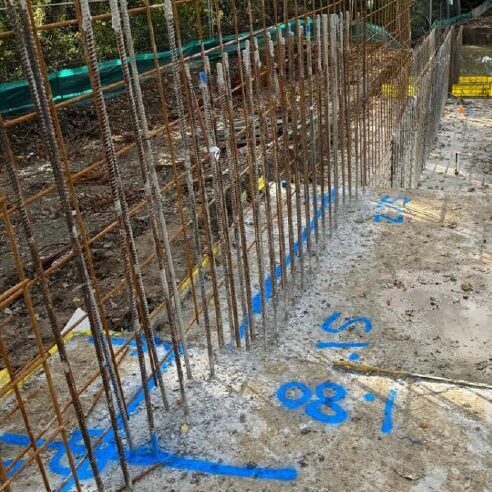
Setting-Out Services cover all archaeological, construction and civil engineering works. Our Archaeological Surveyor has 10 years of experience using Total Stations and GPS to deliver precise, reliable, and efficient setting out. Prior to commencing a project, we carefully review all drawings to ensure designs are fully coordinated and feasible. Our surveyor is experienced in raising RFIs and performing quality checks to ensure all work is accurate, up-to-date, and compliant with project requirements.
We do not just set out points; we liaise closely with your site team to ensure everyone understands what has been set out. Our proactive approach ensures potential errors are eliminated, efficiency is improved, and essentially, clear communication is achieved across the project.
Our wide experience includes archaeological sites, topographic survey, housing projects, RC works, roads, 278 works and drainage. We are able to undertake projects of any size, from small-scale works to large developments.
We also provide material take-off services, including quantities of kerbs (type and linear meterage), volumes for footings, drainage, stone, and other construction materials.
In addition, many projects encounter issues with drawings that are incomplete, inaccurate, or require clarification before construction begins—or during construction when new revisions are issued. By proactively reviewing drawings to ensure the project is buildable and coordinated, we prevent costly delays, avoid unnecessary costs, and keep the project on schedule.
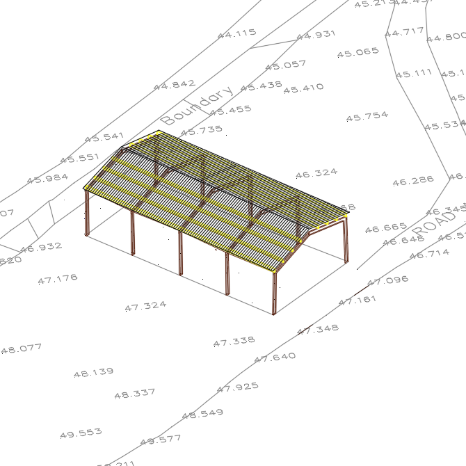
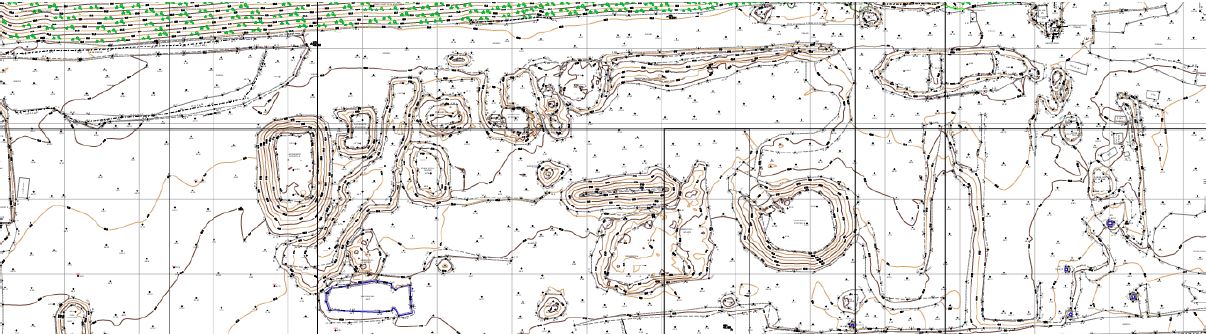
Topographical surveys form a fundamental part of both the design and construction stages of a project. Our surveys ensure accurate geospatial data for design development, including existing ground levels, surface features, and constraints, all referenced to an agreed coordinate system and datum.
We also deliver ‘as-built’ topographical surveys to verify constructed works against design, supporting quality assurance, compliance checks, and record drawings. These surveys can be used to identify and confirm existing and underlying surfaces, interfaces with adjacent works, and potential conflicts, providing a reliable dataset for validation, design coordination, and construction control.